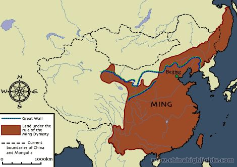
Ming Dynasty's Map
This is the map of the Ming Dynasty, (1368-1644) the blue line is the Great Wall of China. The dash lines are the current boundaries of China and Mongolia, and the orange brownish area was the Ming Dynasty. The Ming wanted to expand their Dynasty but they failed, they were also afraid that they would lose half of their land by other people. During the Ming Dynasty emperor Hongwu was the first emperor to make a trade exploration of the outside world, it became very popular that painter Marco Polo was using it.
No comments:
Post a Comment